November 27, 2017
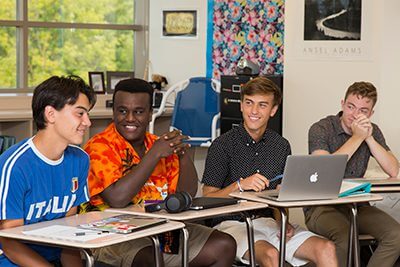
 Upper School history teacher
Lower and Middle School parent
How many years have you been at MPA?
This is my 14th year teaching at MPA.
What do you love about MPA?
Usually, when we talk about people being themselves at MPA, we are referencing the students. This is absolutely a strength of the school and a huge part of the reason that I choose to send my two boys to MPA. At the same time, I also love to work at MPA because I too have the freedom to be myself. Students rarely snicker when I get worked up about the pre-Civil War caning of Sumner or tear up over the trauma of 9/11. Instead, they are willing to let go of their own adolescent insecurities and uncertainties and join me in an intense and personal exploration of history. This makes every day in the classroom unimaginably fulfilling and explains why I love MPA.
How does MPA nurture students who forever dream big and do right?
I think I have grown particularly interested in the “Do Right” aspect of this phrase. By studying the mistakes of the past, I stress to students that they can and must do better. While some might see this as a dim or negative approach to teaching history, I hope that it empowers and motivates students to right the wrongs of the past.
What would you tell a parent considering MPA?
“Do you have an hour or two?” is probably how I would start. It is that difficult to capture the full power of an MPA education. Recognizing, however, that time is short, I would stress that MPA equips students with the knowledge, skills, and attitude to make the world a better place, thereby making their lives richer and more fulfilling. Read More
 As of noon, MPA families have raised an incredible $41,028. If we reach $75,000, a generous family will give a bonus gift of $25,000 to get us to the goal of $100,000 today! Incredible!As of noon, MPA families have raised an incredible $41,028. If we reach $75,000, a generous family will give a bonus gift of $25,000 to get us to the goal of $100,000 today! Incredible!
 How much time does your child spend looking at screens? On average, children spend six and a half hours a day on screens, and that’s not including in the classroom or while doing homework. Do you think violent video games desensitize people to violence? Have you experienced people using screens to avoid face-to-face interactions? Does your child ever make comments online that he or she wouldn’t make in person? These are all questions that every parent struggles with and MPA would like to help better equip you to navigate this important issue.
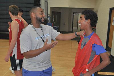 Mounds Park Academy Boys Basketball is thrilled to announce Jacob Schwartz ’09 as head varsity coach! He is taking over for Dan Haase, who moved into the role of Athletic Director after 16 years coaching basketball at MPA. Previously, Jacob coached MPA’s Junior Varsity team while also acting as an assistant coach on the Varsity bench.
 Being a parent today is hard work. Like you, I worry a lot about the world my children are growing up in. Uncertainty about the political and social climate of our country and world, increasing access and use of social media and use of screens by our children, fears about bullying and sexual harassment, violence in our schools, churches, and communities, and a rise of anxiety and depression among young people, are just a few examples of my greatest worries.
 MPA alum Zach Quinn ’11 co-founded Love Your Melon and is making an incredible difference in the lives of children and families battling cancer. He is one of many dreamers and doers who have passed through the halls of MPA.
 Class of 2025
 The theme of the Lower School CHAMP assembly Wednesday was “Be brave and dream big.” This represents the new CHAMP character trait, courage, reminding students of how much their dreams matter and to stay true to who they are, think big, take risks, and be courageous in all of their endeavors.
 Visit campus to walk through “Two Perspectives,” a beautiful and expressive tandem photo exhibition by MPA Upper School students Alex Esch and Siri Vorvick! The display opened November 6 in the Gallery. Both students are working toward their Certificates of Distinction and describe their art as purposeful, exploratory, and adventurous.
 Mark your calendars for Give to the Max Day on November 16 and the end of the Fall Campaign on November 17. If we reach our goal of $75,000 that day, a generous MPA family will contribute an additional $25,000, bringing our grand total to $100,00!